Show List
Coordinates
Explore the fascinating world of coordinates with our interactive guide designed for grade 4-6 kids
Coordinates
are a set of numbers or values that are used to locate a specific point on a grid or map. The grid or map is divided into rows and columns, and each point is identified by its position in relation to the rows and columns.A coordinate system is used to specify the position of a point in space, and is typically represented by two or three numbers. The most common coordinate system is the two-dimensional Cartesian coordinate system, which uses an x-axis and a y-axis to identify a point.
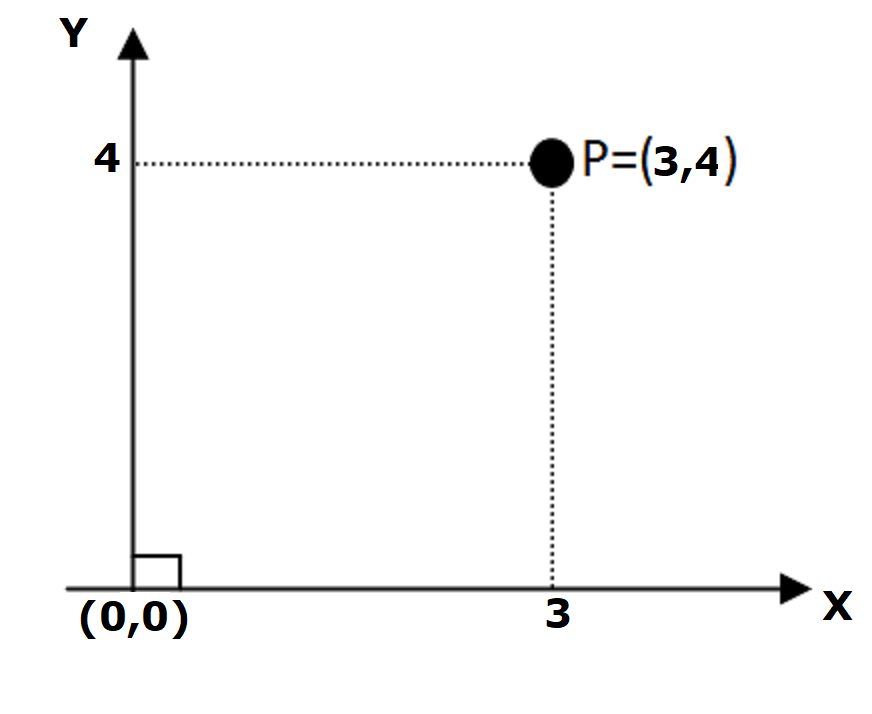
In a two-dimensional Cartesian coordinate system, the x-axis is the horizontal axis and the y-axis is the vertical axis. Each point on the grid is identified by an ordered pair of numbers, called coordinates, in the form of (x,y). The x-coordinate tells us how far to the right or left a point is, and the y-coordinate tells us how far up or down a point is.
For example, the point (3,4) is located 3 units to the right and 4 units up from the origin (0,0).

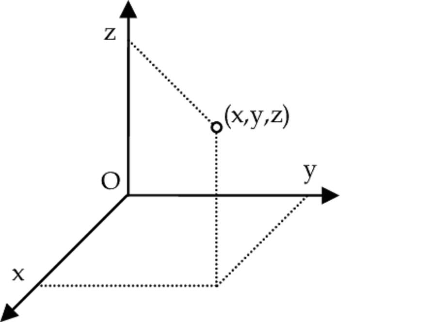
In a three-dimensional coordinate system, a z-axis is added, which tells us how far in or out a point is. The coordinates for a point in a 3D system are represented by a triplet (x,y,z).

Coordinate systems are used in many different fields such as navigation, mapping, and computer graphics.
Leave a Comment